

SPECIALIST MARINE SURVEYORS

Receive A Free Quote From Us Today

SPECIALIST MARINE SURVEYORS

Marine Surveying & Spatial Data Solutions

From coastal mapping and hydrographic surveys to seabed modelling and offshore asset inspections, Nautidata delivers accurate marine survey data tailored to the needs of today's maritime industries.
Built on the proven Archidata platform, Nautidata combines trusted technology with marine-specific expertise to provide reliable, high-quality data for projects across coastal, offshore and inland environments.

MARINE DATA SOLUTIONS

Explore Our Key Services

Marine Laser Scanning

Marine Sectors

We're Trusted, Nationwide.

Posted on Google Google
Jules Munns profile picture
Jules Munns
Google star 1Google star 2Google star 3Google star 4Google star 5Trustindex verifies that the original source of the review is Google.
Great service, quick and responsive. Willing to explain the things which I didn't know about. Strong recommend.
Posted on Google Google
Jade Phillips profile picture
Jade Phillips
Google star 1Google star 2Google star 3Google star 4Google star 5Trustindex verifies that the original source of the review is Google.
Fantastic service, very reasonably priced. Would definitely use again! Quick turnaround and stress free. Thank you Rob and the team.
Posted on Google Google
Dan Greet profile picture
Dan Greet
Google star 1Google star 2Google star 3Google star 4Google star 5Trustindex verifies that the original source of the review is Google.
We instructed Archidata to undertake an urgent Building Height and Storey Assessment for a complex, split-level period building in Brighton. Rob accommodated the site inspection at very short notice and was professional, responsive and thorough throughout. The building had an unusual configuration requiring careful consideration of both the measured height and statutory storey-counting provisions. Rob took the time to analyse the arrangement properly, seek an additional professional view and provide a detailed, well-reasoned report supported by measured survey information and clear drawings. He was also extremely receptive to feedback and promptly dealt with a few minor administrative amendments before confirming that the final report could be relied upon by the relevant parties. An excellent service from start to finish, particularly given the urgency and complexity of the instruction. I would happily recommend Archidata and will certainly use them again.
Posted on Google Google
C&S profile picture
C&S
Google star 1Google star 2Google star 3Google star 4Google star 5Trustindex verifies that the original source of the review is Google.
Used for a boundary survey capture the location of a hedge in relation to a wire boundary fence. Connor from Archidata captured a lot of detail in the survey which independently documented the layout. Generally Archidata were very responsive and answered any questions raised. Overall pleased with the outcome - it delivered perhaps more than I was expecting.
Posted on Google Google
Karina profile picture
Karina
Google star 1Google star 2Google star 3Google star 4Google star 5Trustindex verifies that the original source of the review is Google.
I contacted Rob at Archidata for advice regarding the boundary of my property, and was amazed at his swift and incredibly detailed and helpful response. It’s such a pleasure to deal with a company like this and I would highly recommend!
Posted on Google Google
Jaimie Blomqvist profile picture
Jaimie Blomqvist
Google star 1Google star 2Google star 3Google star 4Google star 5Trustindex verifies that the original source of the review is Google.
Our architecture firm has worked with Rob and his team at Archidata for many years, and we have always been impressed by their impeccable planning, diligence, and consistently high‑quality work. Rob’s attention to detail and proactive approach make collaboration effortless, and the standard of service has remained exceptional throughout every project.
Posted on Google Google
Phil Brown profile picture
Phil Brown
Google star 1Google star 2Google star 3Google star 4Google star 5Trustindex verifies that the original source of the review is Google.
We have been using Archidata for measured survey work for many years. We always find all members of the team to be helpful, accommodating, easy to work with, accurate and good value for money. We hope to continue to work with them for many more years to come!
Posted on Google Google
Robert Flanagan profile picture
Robert Flanagan
Google star 1Google star 2Google star 3Google star 4Google star 5Trustindex verifies that the original source of the review is Google.
⭐️⭐️⭐️⭐️⭐️ Architdata Ltd recently completed a measured and topographic survey for one of my projects. As an architect, they delivered everything I needed with exceptional professionalism. The survey was detailed, neatly presented, and turned around impressively quickly. The value for money was excellent, and the homeowner was also very impressed with how tidy and pleasant the surveyors were throughout. A fantastic service — highly recommended!
Posted on Google Google
John Foat profile picture
John Foat
Google star 1Google star 2Google star 3Google star 4Google star 5Trustindex verifies that the original source of the review is Google.
As an architect I have commissioned a number of measured surveys from Archidata over the years and they have always provided an excellent service.
Posted on Google Google
Alex K profile picture
Alex K
Google star 1Google star 2Google star 3Google star 4Google star 5Trustindex verifies that the original source of the review is Google.
Professional and proactive service

MARINE SURVEY SPECIALISTS

Why Choose Us?

We combine specialist marine surveying expertise with advanced geospatial data capture to deliver accurate, reliable information that supports coastal, offshore and inland waterway projects from the outset.
Unlike traditional surveying providers, our data is structured to integrate seamlessly into your existing workflows. Whether you require hydrographic surveys, bathymetric models or marine spatial data, our deliverables are tailored to your project requirements, making it easier to analyse, share and act on the information with confidence.

MARINE SURVEY EXPERTISE

We Make Marine Data Easy to Use

Our surveys are carried out using the latest hydrographic and geospatial survey technology, delivering highly accurate data with maximum efficiency. By capturing comprehensive datasets from the outset, we can often provide additional outputs later without the need for costly repeat surveys.
We take the same care with our deliverables as we do with our data capture. Every dataset is organised, clearly structured and quality checked to ensure it is easy to interpret and integrate into your existing workflows.
While many survey providers simply supply raw data, Nautidata goes further by delivering project-ready outputs in the formats you need. Whether it's hydrographic survey data, bathymetric models, GIS datasets or CAD drawings, our information is presented in a logical, intuitive way that saves time and supports better decision-making.
The result is accurate, dependable marine survey data that is easy to work with, helping your projects progress more efficiently from planning through to delivery.

SPECIALIST ARCHITECTURAL SURVEYORS

View Our Latest Projects.

Dive into our case studies and explore the thinking, strategy, and craftsmanship behind our work. Each project showcases our commitment to quality and results.
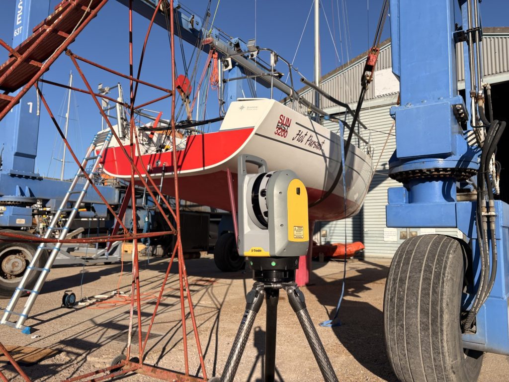
Hot Pursuit – Jeaneau Sunfast 3200 – Cowes Week Winner

Hot Pursuit – Jeaneau Sunfast 3200 – Cowes Week Winner
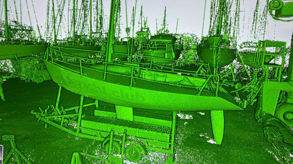
Bad Toad – Tony Castro Quarter Tonner

Bad Toad – Tony Castro Quarter Tonner
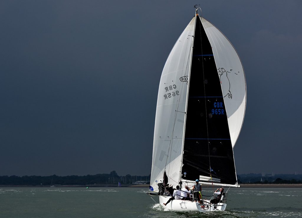
Spider Pig – IRC Optimised Cork 1720 conversion

Spider Pig – IRC Optimised Cork 1720 conversion

Want To Chat? Let’s Talk.

Whether you’re planning a new project or looking to improve what you already have, our team is here to help. Get in touch today and let’s explore the best way forward together.